Posts

Kabir Uddin's Photography
Image
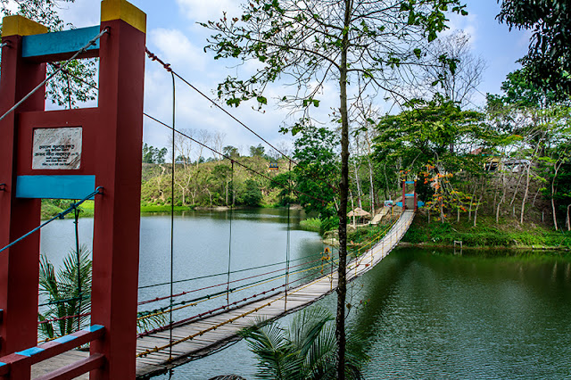
Istockphoto  URL :   https://www.istockphoto.com/portfolio/KabirUddin Meghla Park Lake... Bandarban Park  # Benches  model Things want to see if you are at  World's Longest Sea Beach F ishing life Why People Call ? ‪#‎LongestBeach‬ …. Cox’s bazar It doesn't matter where you are! But it is matter if you not are cycling, St Martin Island Do you like 0ff season ‪#‎Dhaka ‪#‎Krishnachura Blossoms? Visit Bangladesh 2016: welcoming you to Beach City: Cox's Bazar   Reflection of Foys Lake ছাড়িলাম হাছনের নাও রে ‪#‎Sampan ‪#‎boat ‪#‎সামপান ‪#‎নৌকা Ocean has different attraction Banana seller Look at the sky. You are not alone at Cox's Bazar Visit Bangladesh 2016: welcoming you to Beach City: Cox's Bazar Beautiful sky sometimes causes trouble to people Wanna  #boating  experiences on the Sangu River  ‪Ocean has different attraction: Cox's Bazarbeac

About Kabir Uddin

Image
Kabir Uddin is a Bangladeshi national working in the Geospatial Solutions Theme, ICIMOD, Nepal. Where he is involved in Geospatial application in thematic mapping and spatial analysis to ecosystem management, disaster management including capacity building and training. Mr Uddin holds a BSc (Hons) in Geography and Environmental Studies and an MSc in Geography and Environmental Studies, both from the University of Rajshahi, Bangladesh. During his BSc and MSc, he studied geography, environment, geographic information system (GIS) and remote sensing (RS) as major subjects. Mr Uddin has nine years working experience in geographic information systems (GIS) and remote sensing (RS) applications in the field of environmental management. After graduation, he worked at Development Design Consultants Ltd for the Rajshahi City Town Planning Project, where he comprehensively used GIS, Differential Global Positioning System (DGPS) and Total Station for town planning. In 2003, he joined Local Gove

Personal Photo Gallery

Image
Kabir Uddin during a soil erosion talk in Patna, India in 2016 Study tour in Sundarban Study tour in Sundarban Study tour in Sundarban Study Tour to Jamuna Bridge Study Tour to Jamuna Bridge Karate life of Kabir Uddin Karate life of Kabir Uddin

Publication

Image
Saah, D., Tenneson, K., Matin, M., Uddin, K ., Cutter, P., Poortinga, A., ... & Flores, A. (2019). Land cover mapping in data scarce environments: challenges and opportunities. Frontiers in Environmental Science, 7, 150. Khanal, N.; Uddin, K.; Matin, M.A.; Tenneson, K. Automatic Detection of Spatiotemporal Urban Expansion Patterns by Fusing OSM and Landsat Data in Kathmandu. Remote Sens. 2019, 11, 2296. Uddin, K .; Matin, M.A.; Meyer, F.J. Operational Flood Mapping Using Multi-Temporal Sentinel-1 SAR Images: A Case Study from Bangladesh. Remote Sens. 2019, 11, 1581.,   Uddin, K ., Chettri, N., Yang, Y., Lodhi, M. S., Htun, N. Z., & Sharma, E. (2019). Integrating geospatial tools and species for conservation planning in a data-poor region of the Far Eastern Himalayas. Geology, Ecology, and Landscapes, 1-16. Mishra, K., Sinha, R., Jain, V., Nepal, S., & Uddin, K . (2019). Towards the assessment of sediment connectivity in a large Himalayan river basin.

Map Gallery

Image

Useful link

Image
www.scanex.ru/software/scanmagic/default.htm General purpose software for viewing, analyzing and processing remote sensing data under Windows (free version is available). www.posres.co.uk Pocket GIS, the powerful handheld mapping and GIS software solution for WindowsCE http://www.tatukgis.com/ TatukGIS: Home of the TatukGIS Developer Kernel, a comprehensive GIS development toolkit with over 2,000 functions and properties, GIS internet server, and aerial imagery rectification software products. www.manifold.net The site provides inexpensive GIS software, plus lots of downloadable data. GIS Cafe News and current issues in GIS are discussed at this extensive website. Subscribe to free e-mail bulletins to keep up to date. EMEO Group This is the Environmental Modelling and Earth Observation Group webserver hosted by the Department of Geography, University of Wales Swansea. The site contains information pertaining to environmental remote sensing research work being performed by members of th